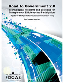
Last year I (along with Brett Goldstein, Chief Data Officer and Chief Information Officer for the City of Chicago) participated in the FOCAS 2012: Towards Open and Innovative Governance conference run by the Communications and Society Program run by the Aspen Institute. They recently published this report based on that conference: Road to Government 2.0: Technological Problems and Solutions for Transparency, Efficiency and Participation. Here’s a PDF of the publication and a relevant snip from the portion I worked on:
Solution 4: Alert System
Even with a heavy media push, many government services may slip by citizens, especially the underprivileged. The problem is, “I do not know what public information and services are available to me when I need and want them,” suggested Caitria O’Neill.
Speaking for another FOCAS working group, O’Neill proposed an opt-in government alert system that would signal citizens as they encounter opportunities for government services, such as moving to a different address. Such a system could also prevent duplicating government services and save on wasted advertising spending. The geolocation-sensitive system would be built out in three phases.
Phase 1: Build a framework for the system. The (very) specific checklist for the framework includes: “A large distributed NoSQL architecture that is cloud-based, that is able to answer spatially relevant queries via a RESTful API,” and that is powered by a combination of tools, such as Hadoop, MongoDB and PostGIS. Governmental and nongovernmental data sources can populate the system, and the team recommends public-private partnerships to maximize the available sources.
Phase 2: Develop and gather information about users, what they might use the information for, and what they need. “Units of government gather information about the consumption of services all the time in the normal course of business. They track things like who is obtaining business licenses and for what purpose, who has a driver’s license, who receives a particular benefit, and so on. There’s nothing new about this and no new systems need be made,” suggested Smart Chicago Collaborative Executive Director Daniel O’Neil.
Phase 3: Marketing. The group preferred that the government provide the service but that it be an open platform for others to offer apps to citizens and consumers. They argued that a private-sector solution “will likely not be provided for free or with the same level of integrity.” Thus they suggested the platform begin with government and foundation funding, as a fee-for-service solution is unlikely to be developed unless the government acts first.
Precautions must be made as to who governs the data and how active the government will be in targeting and advertising to citizens.
This overall concept fits into much of the work Brett has been leading here in Chicago, including the Chicago SmartData Platform, which won $1 million from the Bloomberg Philanthropies Mayors Challenge.
Elliot Ramos of WBEZ did a pretty good job of pulling the City’s various projects together in this post: City tech wonks add toys to Emanuel’s utility belt (disclosure: WBEZ is a grantee of the Chicago Community Trust under the Civic Innovation in Chicago project). Here’s a hefty snip:
While there, Goldstein touted several projects his department has initiated. Many were in testing stages, amounting to Chicago’s own version of Google Labs.
Within the the walls of the Daley Center, Goldstein’s department creates tools, utilizing the mountains of data to inform city managers about the inner workings of the city — sometimes in real time.
The project names are whimsical, but their use could very well alter the way city departments respond with services, perhaps pre-emptively.
Among the tools: Project Unicorn, which was recently renamed Chirp, on a submission to the Knight News Challenge. The city seeks to use that program “to act on city service issues identified via social media — eliminating the need to visit City Hall, call 311, or download special applications,” according to the project submission.
The tool, currently being tested by Goldstein’s department, would allow the city to monitor location-based Tweets and then respond to requests such as street-light outages or graffiti removal.
The city’s also testing Project Falcon, renamed on another submission to the Knight News Challenge as Scout.
About the grant submission, Goldstein said Scout would “aggregate data sources based on location … Applications built using this interface will enable residents to interact with data in a way that’s structured around their day-to-day lives.”
This is above and beyond the SmartData Platform, a separate program developed with funds from the Bloomberg Mayors’ Challenge, according to a spokesperson from Goldstein’s department. The platform’s purpose is allow City Hall to analyze millions of lines of data in real-time and, according to the city, make “smarter, earlier decisions to address a wide range of urban challenges.” The city won $1-million prize from Bloomberg Philanthropies to spend on the project.
Another effort aims to better visualize data using unconventional techniques. This one, dubbedProject Batman, will utilize an immersive, multi-display system called “The Cave.”
The Cave, housed at the University of Illinois at Chicago, has already been used by researchers to visualize environments or biological models.
The display is reminiscent of the computer used by Tom Cruise’s character Chief John Anderton in the 2002 movie Minority Report. That movie is often cited for its near prescience in predictingthe touch-and-swipe interfaces common to iPhones and iPads.
Smart Chicago is deeply interested in helping our founding partner, the City of Chicago move forward on these topics as we execute on our own projects like FoodborneChicago.
