Smart Chicago Collaborative will be hosting an OpenStreetMap Spring #editathon on Saturday, April 26, 2014 from 12:00 – 5:00 PM CST. Ian Dees, a member of the OSM US Board, will be the host of this event. We’re excited to have regular Chicago residents -people who know all about their communities and want to share with the world – to get involved in OpenStreetMap.
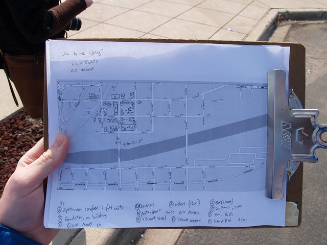
Photo by Steve Vance
If the weather is nice, we’ll also be going outside to do some hands-on mapping in the Loop. We’ll supply some paper maps, pens, and clipboards to make mapping easier, but bring a phone to take pictures.
This should be a great event for anyone to get involved in mapping their communities and to learn about OpenStreetMap.
If you’ve never used OpenStreetMap, here’s a short video by Ian Dees about how it works.
Let’s start mapping!
Related Posts:
-
 Smart Chicago + Code for America Summit 2015
-
 Announcing the April Connect Chicago Meetup: Digital…
-
 Announcing the April 22nd Community Technology Forum…
-
 Surveillance in Chicago: an On The Table Event at…
-
 On the Table 2017: Digital Equity in Education
-
 Documentation from the Community Technology Forum at…